


![]() Various methods and diagnostic tools can be used to survey an area of bocage, depending on the aim of the assessment, the size of the territory and the available resources.
Various methods and diagnostic tools can be used to survey an area of bocage, depending on the aim of the assessment, the size of the territory and the available resources.
![]() Geographic information system (GIS) software makes it possible to model and provide a quantitative description of an area of bocage and its components, based on reference data including IGN BD Ortho® map data and satellite images. This method has been trialled in the Bressuire area in northern Deux-Sèvres, in a project covering more than 80,000 hectares.
Geographic information system (GIS) software makes it possible to model and provide a quantitative description of an area of bocage and its components, based on reference data including IGN BD Ortho® map data and satellite images. This method has been trialled in the Bressuire area in northern Deux-Sèvres, in a project covering more than 80,000 hectares.
![]() Landscape diagnostics in the Bressuire area
Landscape diagnostics in the Bressuire area
![]() ONCFS has developed a nine-class hedge description system for use in field surveys to assess the quality of a bocage area, and in particular its attractiveness to wildlife:
ONCFS has developed a nine-class hedge description system for use in field surveys to assess the quality of a bocage area, and in particular its attractiveness to wildlife:
![]() Hedge classification system
Hedge classification system
![]() A study based on a combination of quantitative and qualitative approaches was conducted at regional level in Limousin.
A study based on a combination of quantitative and qualitative approaches was conducted at regional level in Limousin.
![]() What future for bocage in the Limousin region ?
What future for bocage in the Limousin region ?
![]() Bioindicators provide another means of assessing bocage quality. It is possible to ascertain the quality of bocage at local level (and even measure the effectiveness of management strategies) by monitoring indicator species. Establishing references in this area for research.
Bioindicators provide another means of assessing bocage quality. It is possible to ascertain the quality of bocage at local level (and even measure the effectiveness of management strategies) by monitoring indicator species. Establishing references in this area for research.
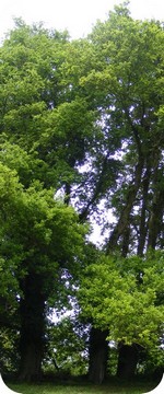
![]() Describing the attractiveness to wildlife of an area of bocage
Describing the attractiveness to wildlife of an area of bocage
A scientific study over three years (on 2011 - 2013) in the Deux-Sèvres bocage :
![]() « Landscapes of bocage and Biodiversity, to integrate reptiles and amphibians into the management academy of the bocage »
« Landscapes of bocage and Biodiversity, to integrate reptiles and amphibians into the management academy of the bocage »
Sample protocol used to survey bird life in meadows and farmland

5 pages / 451 ko


